Difference between revisions of "Photographs"
Jenny Hill (talk | contribs) m |
Jenny Hill (talk | contribs) |
||
| Line 41: | Line 41: | ||
Our content is licensed for reuse through Creative Commons. | Our content is licensed for reuse through Creative Commons. | ||
Be sure to check the licensing of other people's online work before reusing or adapting. | Be sure to check the licensing of other people's online work before reusing or adapting. | ||
| − | [https://www.flickr.com/photos/29388462@N06/albums/72157625653684618 Stormwater and Green Infrastructure Flickr by Chesapeake Bay Program] | + | *[https://www.flickr.com/photos/29388462@N06/albums/72157625653684618 Stormwater and Green Infrastructure Flickr Album by Chesapeake Bay Program] |
| + | *[https://www.flickr.com/photos/8362928@N06/collections/72157651276459681/ Green Roofs of Southern Ontario Flickr Collections by Jenny Hill] | ||
Revision as of 15:13, 26 September 2018
This is a copy of all of the photographs we've gathered on the site, illustrating structural BMPs or specific features. If you can't find what you're after, try checking other people's LID photograph databases
BMPs[edit]
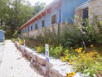
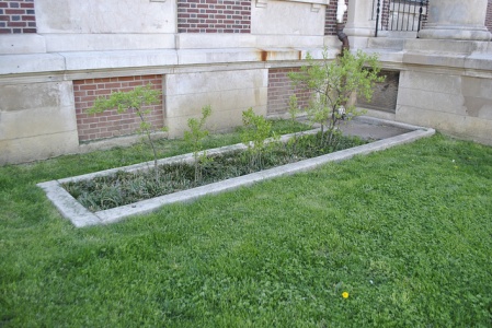
Bioretention cells[edit]
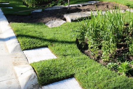
Parking lot bioretention with surface ponding well in foreground, Kortright Centre, Vaughan, ON. Read about the performance of this practice in the technical brief.
Parking lot bioretention sharing underground reservoir with adjacent permeable paving, Edwards Gardens, Toronto, ON. Read a case study about it here.
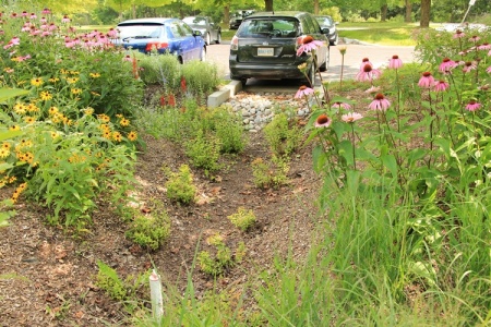
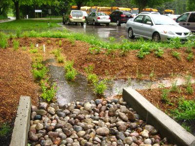
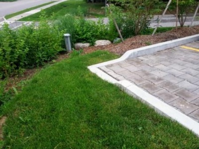
Parking lot bioretention with decorative stone for erosion control, and perforated pipe access standpipe in foreground, Earth Rangers Centre, Vaughan, ON. Read about the performance of this practice in the technical brief.

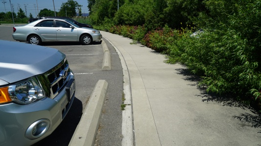
The sunken curb holds the edge of the asphalt pavement and lets water freely flow to the bioretention cell beside the 7sigma parking lot in Minneapolis, MN (USA)
Photo credit:Brian Ash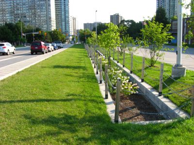
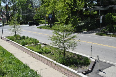
Bioretention cells on Elm Drive, Mississauga, ON, with vertical sides and hardscape perimeter receive road runoff via leader pipes from road catch basin inlets. Read about the stormwater system at this site in the performance assessment report.
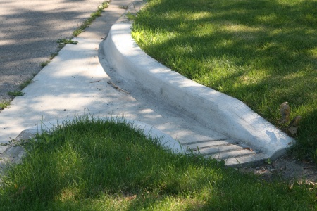
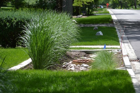
The grade and lack of curb allow for sheet-flow runoff into this bioretention facility. Lakeside Park, Mississauga, ON
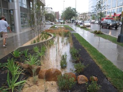
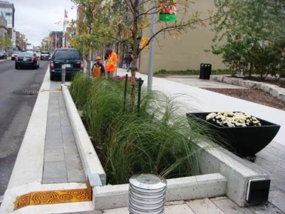
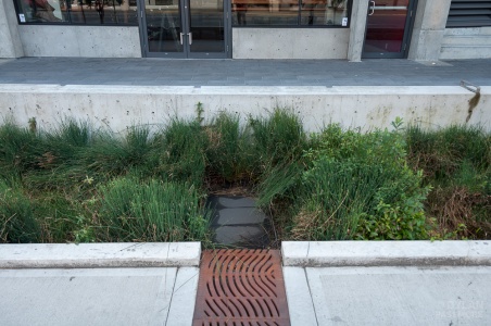
Bioretention cell receiving road and walkway runoff in a high density development setting.
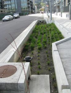
Bioretention bump out in a dense urban setting receiving runoff via side inlet catch basin and curb openings on the walkway side of the installation.
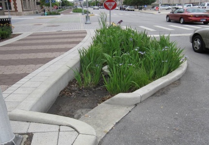
Fairford Parkette featuring a bioretention cell retrofitted into a roadway in downtown Toronto, ON. Read a case study about it here.
Bioretention cell located in Waterfront Park in Ajax, ON.
Parking lot bioretention cell at IMAX corporate headquarters in Mississauga, ON. Read about the IMAX stormwater system in the performance assessment report
A curb extension bioretention cell in action during a major rain event.
Bioretention cell receiving road runoff in the Wychwood neighbourhood of Brampton, ON. The nearby catch basin conveys overflows during major rain events. Read about the stormwater system in this community in the performance assessment report.
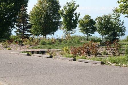
Kortright Centre parking lot bioretention cell in action during a rain event, Vaughan, ON.


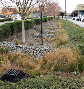
Bioswales[edit]

Streetside swale in Seattle
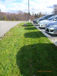
This feature is a bioswale in that the underlying soil has been replaced with engineered filter media. The turf finish simplifies landscape maintenance. Brampton, ON
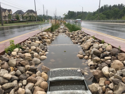
A bioswale located on Country Court Blvd., located in Brampton, ON> Read more about the performance of this feature and associated rpoject, by reading the following Grey to Green Conference Presentation, 2018. Dean Young - STEP, 2018
Bioswale located in Downsview Park, Toronto ON. with Check dams.
Grassed bioswale with Vegetated filter strips
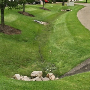
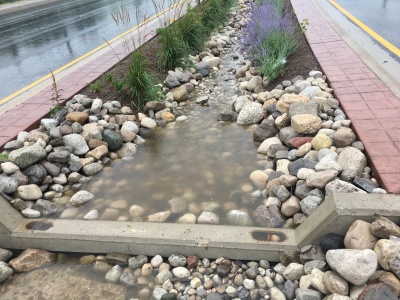
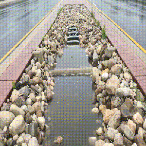
Stone-lined bioswale with rock check dams located to helps slow the flow of water as it enter the system from the nearby roads. [[ STEP, 2017

.jpg)


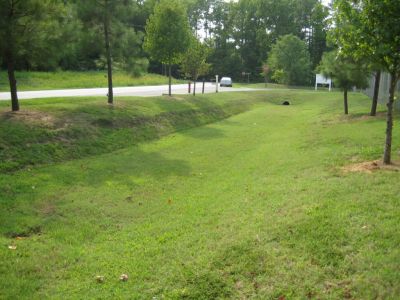
Dry ponds[edit]
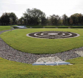
Wishing well park is a baseball field with flood warning signs, Scarborough ON
Avondale Park, designed for flood storage, but not optimized for infiltration, North York ON
A multi-functional dry basin, still due to be fitted with playground equipment. Cambridge, UK. Photo credit: Simon Bunn

Stormwater lagoon, Wilmhurst Road, Warwick. UK. Photo credit: Robin Stott

Dry polder northwest of Vincencov, Prostějov. Czech Republic. Photo credit: Jiří Komárek


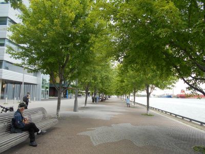
Extended tree pits[edit]
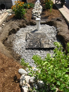
Rainwater harvesting cistern, which discharges to tree pits during dry conditions. Image credit Mississippi WMO

Extended tree pit planting in USA
Photo credit: USEPA
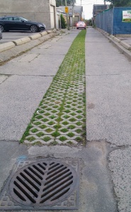
A right of way bioswale installed by the New York City Department of Environmental Protection on Dean Street, Brooklyn

.jpg)

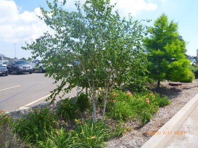
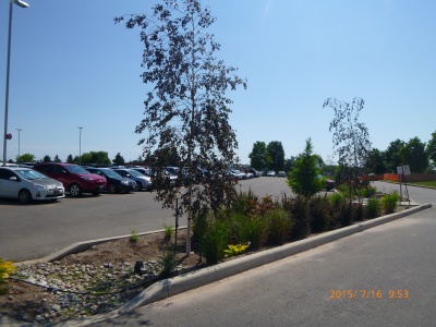
Birch trees in parking lot bioretention 'IMAX site' Mississauga, ON
Trees in parking lot bioretention 'IMAX site' Mississauga, ON


Grass Swales[edit]
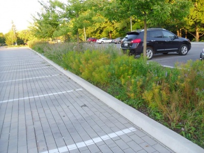
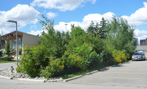
Grass swale in CVC headquarters parking lot, Mississauga ON
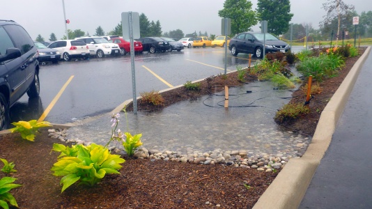
Water distributed into a wide grass swale with a rock level spreader
Flow in this wide swale is being reduced by taller vegetation on some sections (See Manning's n)


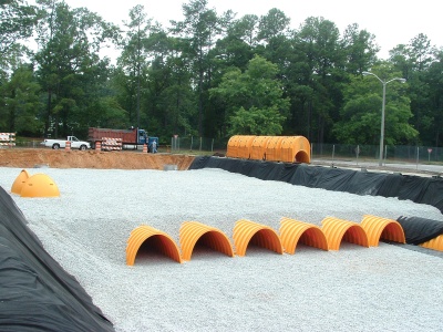
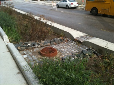
Infiltration chambers[edit]
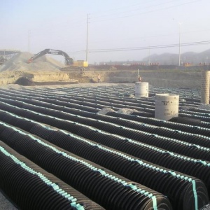
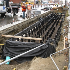
Infiltration chambers being installed.
Chamber systems can be very large, both in terms of depth and footprint...
...or very small as this residential soakaway/dry well.

Parking lot stormwater detention system, partially installed. Photo credit: Arbitrarily0

Contractors construct an underground soakaway on the runway extension of Taxiway Alpha as shown here Oct. 5, 2012, at RAF Mildenhall, England. Photo credit: Karen Abeyasekere
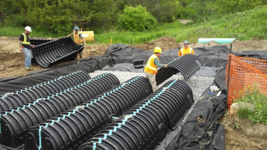
Infiltration chambers being installed.
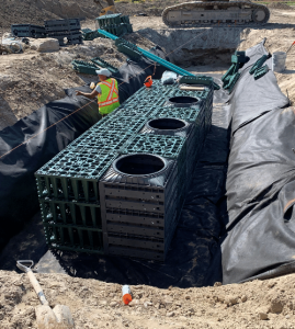
Example of "crate style" Infiltration chambers being installed in East Gwillimbury. Photo credit: Make-Way Environmental Technologies Inc.


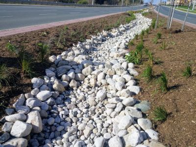
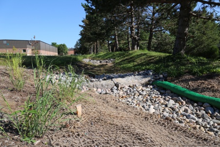
Infiltration trenches[edit]
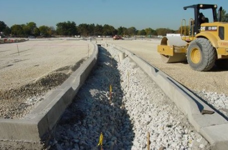
Trench laid in advance of the surrounding catchment being finished. This system would benefit from some geotextile on the surface to prevent sediment from accumulating before the asphalt is laid.
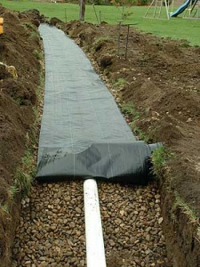
Good use of geotextile, being limited to preventing fines from entering the trench from above.

View of infiltration trench in U.S. Photo credit: Moreau1


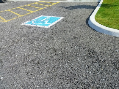
Permeable Pavement[edit]
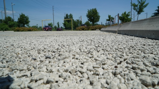
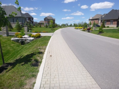
Porous asphalt, Coultice Park, Whitchurch-Stoufville, ON
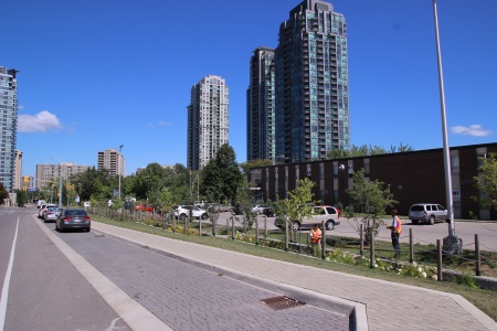
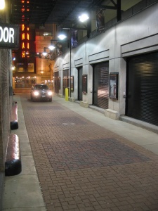
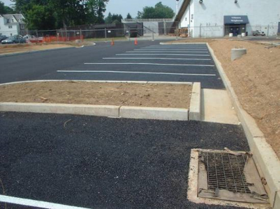
Laneways retrofit program, Toronto ON
Permeable concrete at Lakeside Park, Mississauga ON
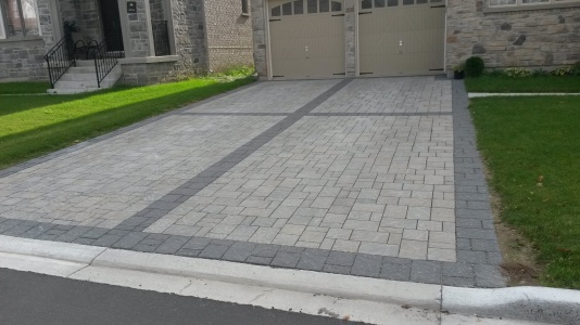
Permeable pavers on residential driveways, Brampton ON
Permeable pavers on a shared street, Georgetown ON
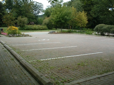
Permeable pavers in parking bays, Mississauga ON (note inspection of bioretention occurring in the background)
Although this permeable pavement at Belfountain Conservation Area was not maintained, it remains structurally sound after over 30 years of constant use.
Pre-cast pervious concrete slab.
Permeable Interlocking Concrete Pavement (PICP) on a narrow road between buildings in Chicago (Source: ICPI)
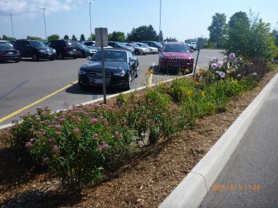
Different colours of permeable pavers in parking lot, CVC headquarters, Mississauga ON
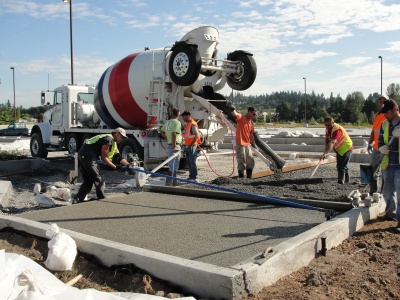
Crews pour pervious concrete into a parking lot (Source: Washington State Dept of Transportation on Flickr)
Inspection wells should be located at the edges or even off the side of permeable pavement areas
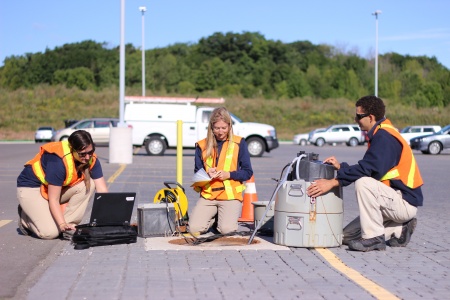
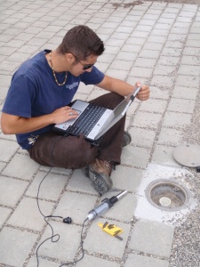
Water quality sampling in permeable pavement study, Mississauga ON
Porous asphalt parking lot (Source: Villanova Urban Stormwater Partnership)
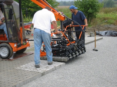
Placement of permeable pavers during construction.


.JPG)


Soil cells[edit]
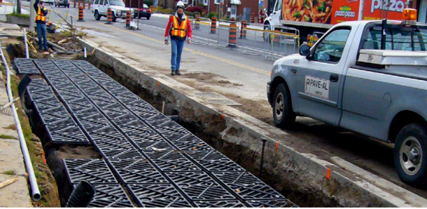
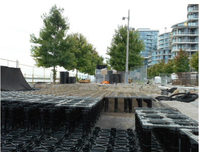
Soil cells under construction.
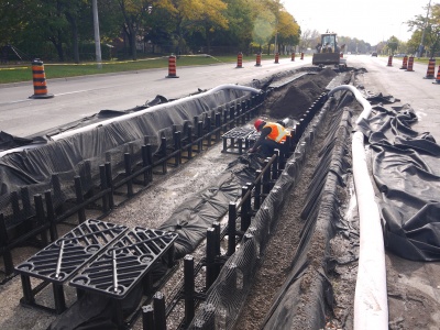
Soil cell installation on Central Parkway in Mississauga.
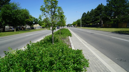
Built in 2014, this stormwater planter on Central Parkway in Mississauga uses supported soil cells and is functioning well.
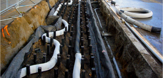
Soil Cell installation along the Moynes and Berl Avenues on north side of The Queensway in Toronto. The picture depicts stormwater distribution pipes through the system, used to help provide water to the trees that will be later planted in the BMP feature.
Photo credit: City of Toronto
Silva Cell “top” deck prior to organic layer and screenings for pavers. Photo credit: City of Toronto
Soil Cells being installed along Edgewater Drive for Waterfront Toronto.
Photo credit: DeepRoot
Stormwater Tree Trenches at East Bayfront Promenade, Toronto.
Photo credit: DeepRoot
Seawall Soil Cells (Tree Trenches) located in Vancouver.
Photo credit:City of Vancouver
Stormwater tree trenches designed with a structural concrete pad over top of the installation.
Photo credit:DeepRoot


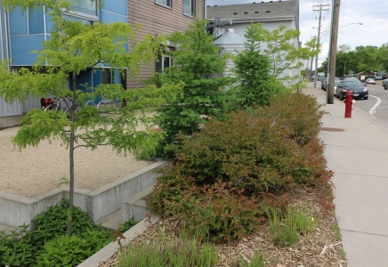
Stormwater planters[edit]
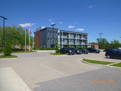
Stormwater planters are ideal for situating alongside buildings to capture rainwater from roof runoff. LSRCA headquarters, 2017.
Stormwater planter, treating downspout runoff, at Waterview Rec Center, Philidelphia
Photo credit: PWD
Rain garden, Illick Hall, SUNY College of Environmental Science and Forestry, Syracuse, NY
Photo credit: DASonnenfeld


Details[edit]
Check dams[edit]
Enhanced swale with rocky check dams and a metal overflow grate in Northgate Mall parking lot, Seattle. Photo credit: MLSmith
Bioswale with rock check dams to slow down the water, encouraging infiltration. Note the biodegradable erosion control blanket still in place. LSRCA headquarters, 2017
A check dam in action, effectively pooling water.
A swale during a rain event, with concrete check dams, armourstone, mulch and Tall grasses to slow down moving water (as shown in the .gif file) to promote infiltration in the feature.


Also see Jen's Pinterest board of check dams
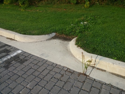
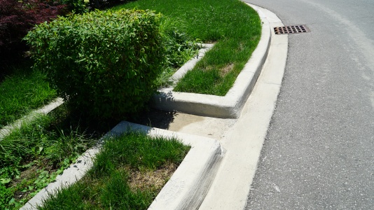
Curb cuts[edit]
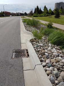
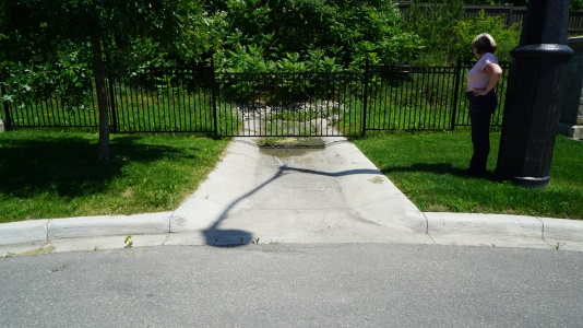
OPSD 605.040 Asphalt Spillway inlet to biofilter swale and road catch basin overflow outlet. County Court Blvd., Brampton, ON.
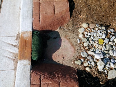
This curb cut has been sawn into existing concrete as part of a retrofit. Note the temporary (erosion log) and permanent stone erosion control measures in place. Mississauga Road, ON.
Curb cut used as a controlled overflow route from permeable pavements to a bioretention facility with monitoring well, Lake Simcoe Region Conservation Authority, Newmarket, ON.

Curb cut into a bioretention facility in Brown Deer, WI. Stone is used to reduce erosion around the inlet area. Photo credit: Aaron Volkening
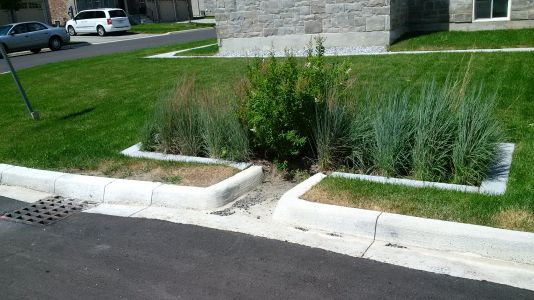
Curb cut into a bioretention facility in Ajax, ON.
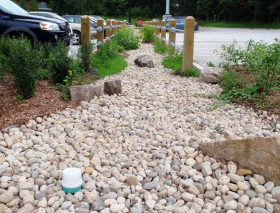
Stone lined inlet at IMAX site in Mississauga
The grading around this inlet prevents flow in the correct direction. i.e. from the pavement onto the grass. Not too critical in this example, as the surface is permeable pavements.
Curb cut into a rain garden on a green street in Newmarket, ON.
Curb cut leading into a small bioretention cell in Brampton, ON.
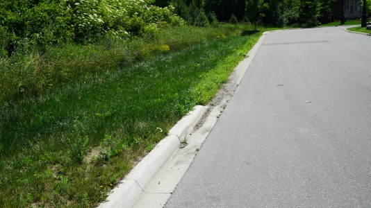
Curb cut leading to a bioswale in Brampton, ON.


Curb extensions[edit]
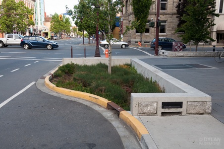
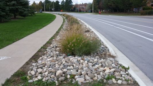
Curb extension in Victoria. Image credit Dylan Passmore
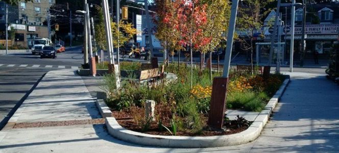
'Offline' streetscape bioretention with trees, King Street, Kitchener
Bioretention on residential street, with covered drain inlet (grate in the gutter) and iron grate covered overflow in the centre of the cell, Hinsdale, IL Photo credit: CNT
Curb extension in downtown Indianapolis, IN
Curb extension on Queen Lane, in Philidelphia
Photo credit: PWD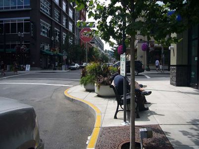
Curb extension with Urban Tree in a tree grate, in city showcased by the U.S Department of Transportation's, Federal Highway Administration.
Photo credit: Jennifer Rosales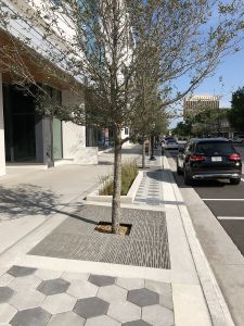
Boulevard with Urban Trees along the boulevard in tree grates, in Orlando, FL.
Photo credit: Design by: GAI Consultants/Kevin Aust & Contractor: UCC Group.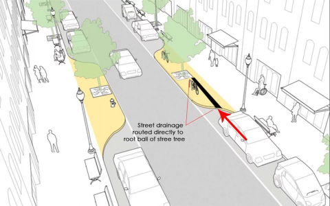
Schematic of Urban Trees in tree grates in a proposed traffic-calming bump-out as part of the on Columbus Av. New York City, NY. The red arrow depicts the flow of water to the stormwater tree trench system.
Photo credit: Jonathan Toner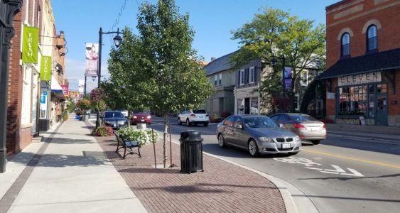
Curb extension with planted tree in open tree pit, part of a finished soil cell system - a tree grate for safety reasons and increased aesthetic should be added. Located on Main St. Markham, ON.
Photo credit: GreenBlue Urban Inc.


Forebays[edit]
Solid splash pad preventing erosion from the flow from the inlet. Image credit Dylan Passmore
Forebay connected to drainage area in the roadway with a curb cut, overflow visible in the centre of the feature, level spreading is encouraged with the rock check dams, Milwaukee, WI, Photo credit: Aaron Volkening
Rounded 'river rock' and a series of check dams slow water from this inlet.
This forebay has a rock splash pad to slow water down before it reaches a bioswale.
Incoming water from these curb cuts is slowed by river rock splash pads.


Overflow structures[edit]
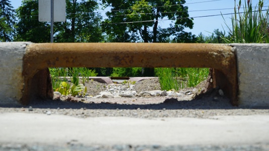
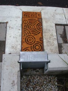
Flat metal overflow with stone surround to reduce erosion around the cast concrete structure. Mississauga Road, ON
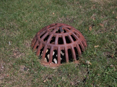
Domed, metal overflow grate. Being flush with the surface reduces potential infiltration of ponded water. Photo credit: Aaron Volkening
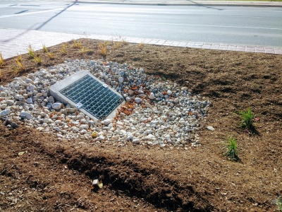
Overflow inlet for newly constructed stormwater bioretention areas in median of Bradley Road. Village of Brown Deer, Wisconsin. Bradley Road, east of 51st Street. Photo from October 2015. Constructed summer 2015.
Photo credit: Aaron Volkening
Flat, metal overflow grate in Emeryville California Stormwater Curb Extension
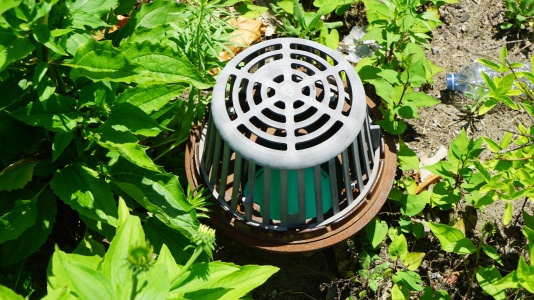
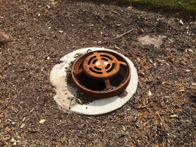
Note the greyish colour change indicating UV degradation of this plastic overflow inlet in a bioretention cell; metal is recommended instead. Mississauga ON.


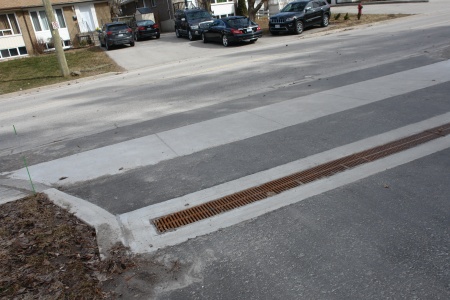
Trench drains[edit]
Combination of trench drain and winter shut off gate: King Street, Kitchener, ON
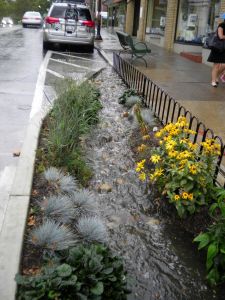
Trench drain that outlets to a bioswale at the LSRCA Office in Newmarket, ON
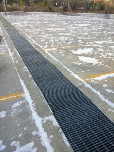
Trench drain in parking lot of Evergreen brickworks, Toronto ON

Bioretention system, or rain garden with a decorative trench drain cover, in Portland, US Taken in April 2013. Photo credit:EmilyBlueGreen
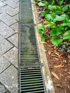
This trench drain has easily opened, hinged sections for maintenance, Singpore


Other databases[edit]
Our content is licensed for reuse through Creative Commons. Be sure to check the licensing of other people's online work before reusing or adapting.