Difference between revisions of "Groundwater"
Jenny Hill (talk | contribs) m |
|||
| (38 intermediate revisions by 5 users not shown) | |||
| Line 1: | Line 1: | ||
| − | |||
| − | This is to mitigate risks due to short periods of groundwater | + | ==Target groundwater separation== |
| − | The design practitioner is advised to consult with approval agencies to understand their requirements and/or expectations prior to undertaking work, and to complete an appropriate level of analysis to support their conclusion. The | + | In many areas of Ontario the target separation between the base of an infiltrating LID practice and the seasonally water table or bedrock surface elevation is 1.0 m. |
| + | This is to mitigate risks due to short periods of groundwater mounding and potentially unobserved seasonal fluctuations. Seasonally high water table elevation should be determined through continuous water level monitoring of wells in the vicinity of the proposed infiltration facilities during spring months (March to June), when water levels in shallow aquifers are typically at their peak. In areas where a 1.0 m separation cannot be provided, or where conditions dictate that an even greater separation may be warranted, additional discussion and/or analysis specific to the physical characteristics of the site and the proposed design should be completed. | ||
| + | The design practitioner is advised to consult with approval agencies to understand their requirements and/or expectations prior to undertaking work, and to complete an appropriate level of analysis to support their conclusion. The detail of investigation and/or documentation supporting a proposed design may be reduced in areas where ≥ 1.0 m separation is anticipated. | ||
Retention of an unsaturated zone beneath the practice : | Retention of an unsaturated zone beneath the practice : | ||
*Minimizes the potential for functional impacts associated with reduced percolation rates, | *Minimizes the potential for functional impacts associated with reduced percolation rates, | ||
*Maintains the physical and biochemical water quality treatment benefits provided within the vadose zone. | *Maintains the physical and biochemical water quality treatment benefits provided within the vadose zone. | ||
| − | + | ||
==Groundwater mounding== | ==Groundwater mounding== | ||
| − | Groundwater mounding describes the | + | Groundwater mounding describes the localized raising of the water table beneath infiltration practices. It may be of concern if it affects nearby structures including building foundations. |
| − | When you wish to model the extent of groundwater mounding beneath an infiltration facility | + | When you wish to model the extent of groundwater mounding beneath an infiltration facility, use this Tool that incorporates Hantush's derivation (1967). |
| + | |||
| + | {{Clickable button|[[Media:Hantush.xlsm|Download the Hantush groundwater mounding tool]]}} | ||
| − | |||
Note that this is a minor adaptation (metric units and formatting) from the original tool, written and [https://pubs.usgs.gov/sir/2010/5102/ hosted by the USGS]. | Note that this is a minor adaptation (metric units and formatting) from the original tool, written and [https://pubs.usgs.gov/sir/2010/5102/ hosted by the USGS]. | ||
| − | === | + | ===Preventing groundwater interaction=== |
| − | [[ | + | Many LID systems rely upon reuse, or evaporation and transpiration instead of infiltration to the ground. If the site cannot support any infiltration, consider |
| − | + | *[[Rainwater harvesting]], | |
| − | + | *[[Stormwater planters]], | |
| − | + | *[[Green roofs]], or | |
| − | and | + | *[[Blue roofs]]. |
| − | + | ||
| − | + | ==Oak Ridges Moraine Groundwater Program== | |
| − | + | [[File:ORMCP_Public_Mapping_Portal_screenshot_2022.png|thumb|ORMGP Public mapping portal]] | |
| − | + | [[File:ORMGP.JPG|thumb|Depth to groundwater raster and contours from the ORMGP]] | |
| − | + | ||
| − | + | The [https://oakridgeswater.ca/ Oak Ridges Moraine Groundwater Program] works collaboratively with government agencies and consultants to better understand and manage the water resources of the Oak Ridges Moraine physiographic region, which stretches from the Credit and Nottawasaga River watersheds in the west, to the Trent River in the east and reaches from the shores of Lake Ontario northwards to Lake Simcoe and the Kawartha Lakes watersheds. The program delivers a multi-agency collaborative approach to collecting, analyzing and disseminating geological and hydrogeological knowledge as a basis for effective decision making and stewardship of water resources in this part of Ontario. Visit the [https://www.oakridgeswater.ca/ program website] to learn more about program elements and publications. Through the [https://maps.oakridgeswater.ca/Html5Viewer/index.html?viewer=ORMGPP public mapping portal] portion of the program website users have the ability to generate maps of estimated water table elevation and depth to water table for sites captured by the regional groundwater model and locate existing well and borehole records. This provides LID designers with a powerful tool for identifying opportunities for, and constraints to implementating stormwater infiltration facilities with regard to groundwater levels. | |
| − | + | ||
| − | + | ===Other sources of groundwater data=== | |
| + | *Ontario Ministry of Natural Resources [https://data.ontario.ca/dataset/geotechnical-boreholes geotechnical boreholes database] | ||
| + | *[http://ontariogroundwater.com/ Ontario groundwater] | ||
| + | *[https://www.ontario.ca/environment-and-energy/map-provincial-groundwater-monitoring-network Provincial groundwater monitoring network map] | ||
| + | |||
| + | ==Planning== | ||
| + | ===Hydrogeology=== | ||
| + | The Conservation Authorities Geoscience Group has prepared a guidance document which attempts to standardize the hydrogeological study requirements for development applications made to Conservation Authorities. It is a helpful guide for all low impact development applications which include infiltration. It is provided with the caveat that not all sections or content are necessary or appropriate for every case. Pre-consultation with your local conservation authority and municipality is strongly recommended in all cases. | ||
| + | |||
| + | '''[http://www.lsrca.on.ca/Shared%20Documents/permits/hydrogeological%20_guidelines.pdf?pdf=Hydrogeological-Guidelines Hydrogeological Assessment Submissions Conservation Authority Guidelines for Development Applications]''' | ||
| + | |||
| + | ==Beginning an infiltration BMP design?== | ||
| + | See [[Infiltration: Testing| Infiltration testing]] and [[Design infiltration rates]] pages | ||
| − | == | + | ==See also== |
| − | + | *[[Site considerations]] | |
---- | ---- | ||
| + | [[Category:Infiltration]] | ||
Latest revision as of 17:52, 12 April 2024
Target groundwater separation[edit]
In many areas of Ontario the target separation between the base of an infiltrating LID practice and the seasonally water table or bedrock surface elevation is 1.0 m. This is to mitigate risks due to short periods of groundwater mounding and potentially unobserved seasonal fluctuations. Seasonally high water table elevation should be determined through continuous water level monitoring of wells in the vicinity of the proposed infiltration facilities during spring months (March to June), when water levels in shallow aquifers are typically at their peak. In areas where a 1.0 m separation cannot be provided, or where conditions dictate that an even greater separation may be warranted, additional discussion and/or analysis specific to the physical characteristics of the site and the proposed design should be completed. The design practitioner is advised to consult with approval agencies to understand their requirements and/or expectations prior to undertaking work, and to complete an appropriate level of analysis to support their conclusion. The detail of investigation and/or documentation supporting a proposed design may be reduced in areas where ≥ 1.0 m separation is anticipated.
Retention of an unsaturated zone beneath the practice :
- Minimizes the potential for functional impacts associated with reduced percolation rates,
- Maintains the physical and biochemical water quality treatment benefits provided within the vadose zone.
Groundwater mounding[edit]
Groundwater mounding describes the localized raising of the water table beneath infiltration practices. It may be of concern if it affects nearby structures including building foundations. When you wish to model the extent of groundwater mounding beneath an infiltration facility, use this Tool that incorporates Hantush's derivation (1967).
Note that this is a minor adaptation (metric units and formatting) from the original tool, written and hosted by the USGS.
Preventing groundwater interaction[edit]
Many LID systems rely upon reuse, or evaporation and transpiration instead of infiltration to the ground. If the site cannot support any infiltration, consider
Oak Ridges Moraine Groundwater Program[edit]
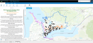
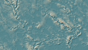
The Oak Ridges Moraine Groundwater Program works collaboratively with government agencies and consultants to better understand and manage the water resources of the Oak Ridges Moraine physiographic region, which stretches from the Credit and Nottawasaga River watersheds in the west, to the Trent River in the east and reaches from the shores of Lake Ontario northwards to Lake Simcoe and the Kawartha Lakes watersheds. The program delivers a multi-agency collaborative approach to collecting, analyzing and disseminating geological and hydrogeological knowledge as a basis for effective decision making and stewardship of water resources in this part of Ontario. Visit the program website to learn more about program elements and publications. Through the public mapping portal portion of the program website users have the ability to generate maps of estimated water table elevation and depth to water table for sites captured by the regional groundwater model and locate existing well and borehole records. This provides LID designers with a powerful tool for identifying opportunities for, and constraints to implementating stormwater infiltration facilities with regard to groundwater levels.
Other sources of groundwater data[edit]
- Ontario Ministry of Natural Resources geotechnical boreholes database
- Ontario groundwater
- Provincial groundwater monitoring network map
Planning[edit]
Hydrogeology[edit]
The Conservation Authorities Geoscience Group has prepared a guidance document which attempts to standardize the hydrogeological study requirements for development applications made to Conservation Authorities. It is a helpful guide for all low impact development applications which include infiltration. It is provided with the caveat that not all sections or content are necessary or appropriate for every case. Pre-consultation with your local conservation authority and municipality is strongly recommended in all cases.
Beginning an infiltration BMP design?[edit]
See Infiltration testing and Design infiltration rates pages

