Uncategorized files
Jump to navigation
Jump to search
Showing below up to 50 results in range #731 to #780.
View (previous 50 | next 50) (20 | 50 | 100 | 250 | 500)
 Maintenance of plants green roof.PNG 460 × 776; 751 KB
 Maintenance of treetrench.PNG 636 × 333; 610 KB
 Major Arterial Cross Section.png 978 × 605; 367 KB
 Marginal shield fern.jpg 450 × 316; 30 KB
 Mariotte Guelph.jpg 427 × 835; 29 KB
 Markham grenprint study.PNG 817 × 350; 488 KB
 Matusik 2004.pdf ; 1.63 MB
 Maxresdefault.jpg 1,280 × 720; 84 KB
 Meadows in the Glen PP sidewalk and driveway bibs .jpg 4,608 × 3,456; 6.16 MB
 Media hand.jpg 1,728 × 3,072; 1.48 MB
 Millgroup green roof.PNG 813 × 555; 537 KB
 Mini&high freq green roof.PNG 1,195 × 721; 183 KB
 Minimum & hig hfreq cost p.p.PNG 1,230 × 689; 191 KB
 Minimum & hig hfrequency costs.pp.JPG 678 × 508; 70 KB
 Minimum high fre cost underground.PNG 1,019 × 552; 115 KB
 Minor Arterial Road Cross Section.png 977 × 607; 322 KB
 Mississauga - Central Parkway - silva cell installation.JPG 2,816 × 2,112; 1.43 MB
 Mississauga Elm Dr bioswale 001.jpg 2,816 × 2,112; 2.45 MB
 Mississauga IMAX parking bioret 1.JPG 4,000 × 3,000; 5.02 MB
 Mississauga Lakeview bioret 1.JPG 5,184 × 3,456; 6.89 MB
 Mississauga Rd.gif 400 × 400; 39.01 MB
 Mississauga Road - Brampton - curb cuts.JPG 4,240 × 2,384; 6.88 MB
 Modified Philip Dunne.PNG 542 × 682; 630 KB
 Monitor Fail p.p.JPG 623 × 423; 34 KB
 Monitor Pass p.p.JPG 634 × 424; 77 KB
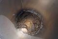
 Monitoring-well-subgrade.jpg 4,000 × 3,000; 4.53 MB
 MonitoringWell bio fail.PNG 833 × 567; 1.04 MB
 MonitoringWell bio pass.PNG 842 × 562; 1.25 MB
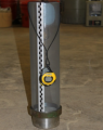
 Monitoring well.gif 478 × 512; 29 KB
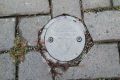
 Monitoring well chamber.PNG 328 × 381; 197 KB
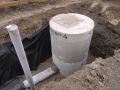
 Monitoring well fail underground.PNG 497 × 364; 546 KB
 Monitoring well pass underground.PNG 481 × 361; 523 KB
 Muhlenbergia mexicana.jpg 500 × 375; 165 KB
 Multi-barrier-safe-drinking-water-co.jpg 740 × 869; 129 KB
 Nacto Sumpinlet bio.jpg 675 × 675; 604 KB
 Native Child.jpg 960 × 720; 383 KB
 Natural Ground Cover.png 902 × 692; 398 KB
 New York Bumpout.PNG 1,199 × 750; 687 KB
 Newly developed swale.PNG 456 × 700; 858 KB
 North Dakota State U infiltration trench.jpg 300 × 400; 28 KB
 Nutrient retention bio.PNG 1,010 × 503; 891 KB
 O'COnnor Park.PNG 813 × 382; 425 KB
 OGS-Lab-Testing.jpg 1,024 × 768; 122 KB
 OGS-Protocol-Webpage-Image.jpg 381 × 508; 32 KB
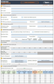 OGS Calculation Tool.PNG 561 × 863; 158 KB
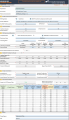 OGS Calculation Tool 2024.png 2,009 × 3,496; 1.48 MB
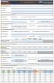 OGS Calculation Tool UPDATE.png 561 × 863; 147 KB
- OGS IS 14034 ETV Scour.pdf ; 186 KB
- OGS IS 14034 ETV Scour update.pdf ; 244 KB
 OGS IS 14034 Scours.JPG 778 × 65; 18 KB


