Difference between revisions of "Site conditions: road right of ways"
Kyle menken (talk | contribs) m |
Jenny Hill (talk | contribs) |
||
| (5 intermediate revisions by 2 users not shown) | |||
| Line 1: | Line 1: | ||
Understanding site conditions is critical when [[Screening LID Options]]. Gaining comprehensive knowledge of the proposed site requires a desktop review of relevant background information followed by field reconnaissance to verify the review and identify relevant site conditions not included in background information. | Understanding site conditions is critical when [[Screening LID Options]]. Gaining comprehensive knowledge of the proposed site requires a desktop review of relevant background information followed by field reconnaissance to verify the review and identify relevant site conditions not included in background information. | ||
| − | + | == Desktop Analysis of Background Documents == | |
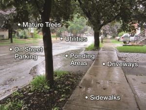
| − | [[File:Site Conditions ROW.jpg|thumb| Analyzing streetview shots | + | [[File:Site Conditions ROW.jpg|thumb| Analyzing streetview shots is a helpful desktop exercise]] |
| − | Reviewing background information will help provide preliminary understanding of side conditions, scope technical investigations for the site and determine project targets. It’s best to collect and review this information prior to field reconnaissance so that it is targeted and efficient use of time. | + | Reviewing background information will help provide preliminary understanding of side conditions, scope technical investigations for the site and determine project targets. It’s best to collect and review this information prior to field reconnaissance so that it is a targeted and efficient use of time. |
Relevant background information includes but is not limited to: | Relevant background information includes but is not limited to: | ||
| + | <div style="column-count:2;-moz-column-count:2;-webkit-column-count:2"> | ||
* Municipal road sections and profiles | * Municipal road sections and profiles | ||
* Construction drawings from adjacent properties | * Construction drawings from adjacent properties | ||
* Servicing drawings (hydro, phone, gas, cable, and other utilities) | * Servicing drawings (hydro, phone, gas, cable, and other utilities) | ||
| − | * Grading plans | + | * [[Grading]] plans |
* Stormwater management and drainage reports | * Stormwater management and drainage reports | ||
* Reports of flooding from adjacent households | * Reports of flooding from adjacent households | ||
| Line 20: | Line 21: | ||
* Surficial soils and geology data | * Surficial soils and geology data | ||
* Geotechnical investigations and reports | * Geotechnical investigations and reports | ||
| − | * Digital base mapping (GIS) showing roads, buildings, property fabric, watercourses, storm and sanitary sewer infrastructure, and | + | * Digital base mapping (GIS) showing roads, buildings, property fabric, watercourses, storm and sanitary sewer infrastructure, and watermains |
* Relevant local policies, by-laws and standards | * Relevant local policies, by-laws and standards | ||
| − | * Standard templates for design drawings and tender document | + | * Standard templates for design [[drawings]] and tender document |
* Watershed or subwatershed studies | * Watershed or subwatershed studies | ||
| − | + | </div> | |
| + | |||
| + | == Field Reconnaissance of Site Conditions == | ||
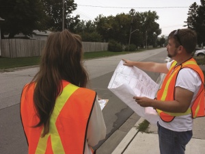
[[File:Site Conditions Road Right of Way Cover.jpg|thumb|Field reconnaissance to verify desktop analysis is critical]] | [[File:Site Conditions Road Right of Way Cover.jpg|thumb|Field reconnaissance to verify desktop analysis is critical]] | ||
| − | + | The next step is to assess site conditions in order to confirm your assessment, to determine the technical feasibility of implementing LID practices within the municipal right-of-way (ROW), to scope existing drainage features and general ROW characteristics, and to identify and confirm any existing constraints. Pay attention to the function of adjoining land uses and activities occurring in and around the site. | |
Site specific constraints, considerations, and conditions that can be identified during a field visit include: | Site specific constraints, considerations, and conditions that can be identified during a field visit include: | ||
| Line 36: | Line 39: | ||
**Minor arterial road | **Minor arterial road | ||
**High density commercial road | **High density commercial road | ||
| − | + | ||
| − | [[File:Site Conditions ROW2.jpg|thumb| Car parked within the drainage ditch | + | Also determine what type of road reconstruction is feasible: |
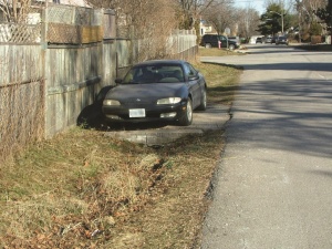
| + | [[File:Site Conditions ROW2.jpg|thumb| Car parked within the drainage ditch. Will this continue after the LID road retrofit?]] | ||
{| class="wikitable" | {| class="wikitable" | ||
|- | |- | ||
| Line 44: | Line 48: | ||
| | | | ||
| − | + | Grinding of the base and top asphaltic compound to some nominal depth from the existing road surface and allowing for approximately 15-30% spot base repair where required while maintaining the original vertical design of the road. | |
| − | |||
| − | |||
May also include: | May also include: | ||
| − | + | *Repair or replacement of concrete curb and installation of sub-drains | |
| − | + | *Repair of concrete sidewalks | |
| − | + | *Adjustment and/or replacement of driveway aprons and sod | |
| − | |||
| − | |||
| − | |||
| − | |||
|- | |- | ||
| | | | ||
| Line 61: | Line 59: | ||
| | | | ||
| − | Complete removal and replacement of the major ROW elements including the road base | + | Complete removal and replacement of the major ROW elements including the road base, asphalt surface, concrete curb and sidewalks. Complete replacement can include reconstruction or replacement of the sub-surface (hydro, gas, water main, sanitary and stormwater infrastructure). |
| − | |||
| − | stormwater infrastructure). | ||
| − | |||
| − | + | Another type of road reconstruction converts rural cross-section roadway into an urban cross section. This typically includes the installation of storm sewers, complete base and asphalt replacement, concrete curb placement, placement of sub-drains under curbs and catch basin placement. | |
| − | Another type of road reconstruction | ||
|- | |- | ||
| Line 74: | Line 68: | ||
| | | | ||
| − | As areas urbanize or infrastructure is upgraded rural cross section streets may be converted to an urban cross-section with curbs, gutters and storm sewers. | + | As areas urbanize or infrastructure is upgraded, rural cross section streets may be converted to an urban cross-section with curbs, gutters and storm sewers. These upgrades are one of the most common and provide economically feasible opportunities for LID incorporation. |
|- | |- | ||
| Line 81: | Line 75: | ||
| | | | ||
| − | + | The effective width or number of travel lanes contained in a crosssection is reduced in order to achieve system improvements. Roadway reductions can be used for traffic calming purposes, transit projects, alternative transportation strategies (e.g. introducing bicycle lanes), and pedestrian crossings. Through the process of roadway reduction, areas of the ROW that were used for vehicular travel are converted to sidewalks, landscaped boulevards and bicycle lanes. | |
| − | |||
| − | the process of roadway reduction, areas of the ROW that were used for vehicular travel are converted to sidewalks, landscaped boulevards | ||
|} | |} | ||
| − | + | Other conditions to note: | |
| − | + | *Local landscaping features and the landscape aesthetic of the surrounding site area | |
| − | + | *Overhead or underground utilities | |
| − | + | *Utility lines not marked in the drawings | |
| − | + | *Traffic patterns or safety concerns. How could the LID practice assist in traffic calming? | |
| − | + | *Parking volume and location | |
| − | + | *Encroachment issues. Are there structures or features, such as fences, present on the ROW? | |
| − | + | *Paved boulevard areas | |
| − | + | *Irregular surface drainage patterns, ponding, or lack of conveyance | |
| − | + | *Adjoining land use. Are any activities present that could impact ROW retrofit design, construction, or maintenance (i.e. excess garbage)? | |
| − | + | *Use of the site. Do residents use the ROW site to access other amenities, such as a transit shelter? Do they use it for parking? | |
| − | + | *Current maintenance practices within the ROW | |
| − | + | *Are mature trees present? Could they impact construction, operations, and maintenance of the LID feature? | |
| − | + | *Project support –property owners might choose to get involved in LID, but renters might not be inclined | |
| + | Once you have collected the necessary site condition information, return to [[Screening LID Options]] | ||
| − | + | [[Category:Planning]] | |
Latest revision as of 00:29, 19 October 2018
Understanding site conditions is critical when Screening LID Options. Gaining comprehensive knowledge of the proposed site requires a desktop review of relevant background information followed by field reconnaissance to verify the review and identify relevant site conditions not included in background information.
Desktop Analysis of Background Documents[edit]
Reviewing background information will help provide preliminary understanding of side conditions, scope technical investigations for the site and determine project targets. It’s best to collect and review this information prior to field reconnaissance so that it is a targeted and efficient use of time.
Relevant background information includes but is not limited to:
- Municipal road sections and profiles
- Construction drawings from adjacent properties
- Servicing drawings (hydro, phone, gas, cable, and other utilities)
- Grading plans
- Stormwater management and drainage reports
- Reports of flooding from adjacent households
- Sump-pump and foundation drain connection information
- Local stormwater management criteria
- Hydrologic models
- Hydraulic models
- Orthophotography and aerial photos
- Surveys
- Local digital elevation model (DEM)
- Surficial soils and geology data
- Geotechnical investigations and reports
- Digital base mapping (GIS) showing roads, buildings, property fabric, watercourses, storm and sanitary sewer infrastructure, and watermains
- Relevant local policies, by-laws and standards
- Standard templates for design drawings and tender document
- Watershed or subwatershed studies
Field Reconnaissance of Site Conditions[edit]
The next step is to assess site conditions in order to confirm your assessment, to determine the technical feasibility of implementing LID practices within the municipal right-of-way (ROW), to scope existing drainage features and general ROW characteristics, and to identify and confirm any existing constraints. Pay attention to the function of adjoining land uses and activities occurring in and around the site.
Site specific constraints, considerations, and conditions that can be identified during a field visit include:
- Road type
- Local residential road
- Residential collector road
- Local industrial road
- Industrial collector road
- Minor arterial road
- High density commercial road
Also determine what type of road reconstruction is feasible:
|
|
Grinding of the base and top asphaltic compound to some nominal depth from the existing road surface and allowing for approximately 15-30% spot base repair where required while maintaining the original vertical design of the road. May also include:
|
|
|
Complete removal and replacement of the major ROW elements including the road base, asphalt surface, concrete curb and sidewalks. Complete replacement can include reconstruction or replacement of the sub-surface (hydro, gas, water main, sanitary and stormwater infrastructure). Another type of road reconstruction converts rural cross-section roadway into an urban cross section. This typically includes the installation of storm sewers, complete base and asphalt replacement, concrete curb placement, placement of sub-drains under curbs and catch basin placement. |
|
|
As areas urbanize or infrastructure is upgraded, rural cross section streets may be converted to an urban cross-section with curbs, gutters and storm sewers. These upgrades are one of the most common and provide economically feasible opportunities for LID incorporation. |
|
|
The effective width or number of travel lanes contained in a crosssection is reduced in order to achieve system improvements. Roadway reductions can be used for traffic calming purposes, transit projects, alternative transportation strategies (e.g. introducing bicycle lanes), and pedestrian crossings. Through the process of roadway reduction, areas of the ROW that were used for vehicular travel are converted to sidewalks, landscaped boulevards and bicycle lanes. |
Other conditions to note:
- Local landscaping features and the landscape aesthetic of the surrounding site area
- Overhead or underground utilities
- Utility lines not marked in the drawings
- Traffic patterns or safety concerns. How could the LID practice assist in traffic calming?
- Parking volume and location
- Encroachment issues. Are there structures or features, such as fences, present on the ROW?
- Paved boulevard areas
- Irregular surface drainage patterns, ponding, or lack of conveyance
- Adjoining land use. Are any activities present that could impact ROW retrofit design, construction, or maintenance (i.e. excess garbage)?
- Use of the site. Do residents use the ROW site to access other amenities, such as a transit shelter? Do they use it for parking?
- Current maintenance practices within the ROW
- Are mature trees present? Could they impact construction, operations, and maintenance of the LID feature?
- Project support –property owners might choose to get involved in LID, but renters might not be inclined
Once you have collected the necessary site condition information, return to Screening LID Options


